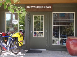
Adventure Cycling Association has recently released their Idaho Hot Springs Maps. There are two maps; the Main Route which describes a 517 mile loop beginning and ending in Idaho City and the Single Track Options map which outlines about 227 miles of optional loops off the main route. The main route is divided into a sort of figure eight with the inclusion of the Lowman Cutoff. There is a spur into Boise for those who want to start and/or finish in Boise. Like all Adventure Cycling maps, these are well researched and very detailed with easy to follow cue sheets and descriptions of conditions to be expected. As of this writing we only have one complete set of the maps available in the Bike Touring News store but will be getting more- these have been popular!
Adventure Cycling Association also pioneered the Great Divide Mountain Bike Route which is popular on the bikepacking circuit, and from all the response we’ve seen, the Idaho Hot Springs route is going to be as popular or more so. We’ll try to get some reports from people we know who have done the hot springs route or portions of it. If you have experience with any portion of the route please share it in the comments and/or send us a link if you have an online journal you would like to share.


Ndn June 29, 2014, 10:28 pm
Jim, I have been on some of the hot springs route towards Idaho city and center ville and placerville before the maps came out and they are awesome. Looking forward to doing more of it piece by piece over the summer. Anybody want to go?
Sky King July 22, 2014, 11:45 am
From Troy Cobbs “I ended up riding a part of the Eagles Nest single track option on the IHSMB route, it was totally cleared by the moto people which is good and bad. It was clear but on the hills the motos have rutted it up to a totally un-ridable condition… so most of the ups and downs I had to hike a bike. I would estimate that Eagles Nest Trail is about 70% ridable. I can say that the dirt road from Eagles Nest down to Goldfork HS is AWESOME…screaming downhill with no traffic and great views FR 400 if my memory serves right.”
Sky King July 22, 2014, 11:55 am
From Chris “Bear Pete (142) is a bear of a trail and is currently being re-routed by the FS.
I would not recommend doing it any sort of loaded…it is knarly, technical
single track and I cannot believe it is a single-track option for the ID hot
springs loop.”
Casey Greene August 4, 2014, 2:13 pm
Interesting. I’ve ridden it loaded twice with a 26in-wheeled-no-suspention-rim-braked-singlespeed, and had a blast both times: http://greenecasey.blogspot.com/2012/09/bikepacking-mccalls-hot-springs.html
The reroute is small and inconsequential to the difficulty of the trail. And, it is a difficult trail.
Bike Hermit™ August 4, 2014, 6:09 pm
Casey, we rode Bear Pete this weekend. I did it on the Big Fat Dummy cargo bike. Lots of pushing, but I think there would be a lot of walking even on a light bike. The motorcycle ruts are getting deep on the northern end. I do think it was worth it though- I could look across Hells Canyon and Seven Devils all the way to the Wallowas!
Casey Greene August 5, 2014, 5:22 pm
Holy crap! I thought I had ridden it on the hardest bike one could and you just totally trumped me! That must have been one big day, but as you said the views are totally worth it.
Bike Hermit™ July 29, 2014, 1:08 pm
This page http://www.adventurecycling.org/routes-and-maps/adventure-cycling-route-network/gps-information/idaho-hot-springs-mountain-bike-route-gps-data/
has links to GPS data for the Hot Springs Route. I just downloaded the apps to my Droid and uploaded the GPS info so now I’m golden!