Spring has arrived here in Boise! Time to strike out on our first overnight trip of the year! Here’s the route we’re planning to attempt:
https://ridewithgps.com/routes/27089400
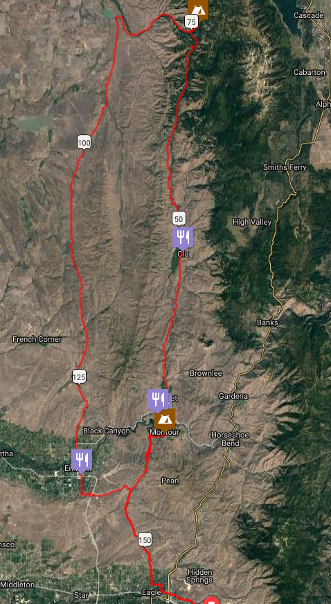
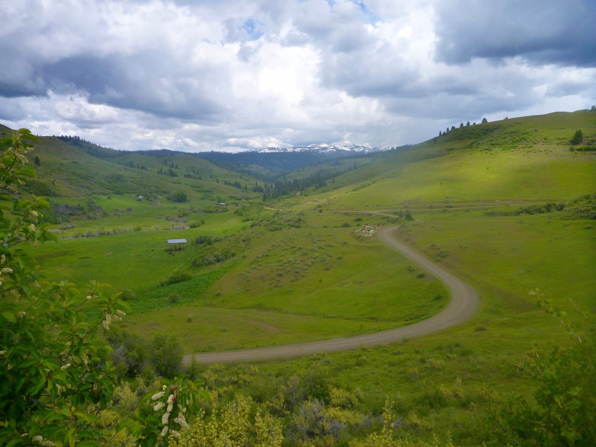
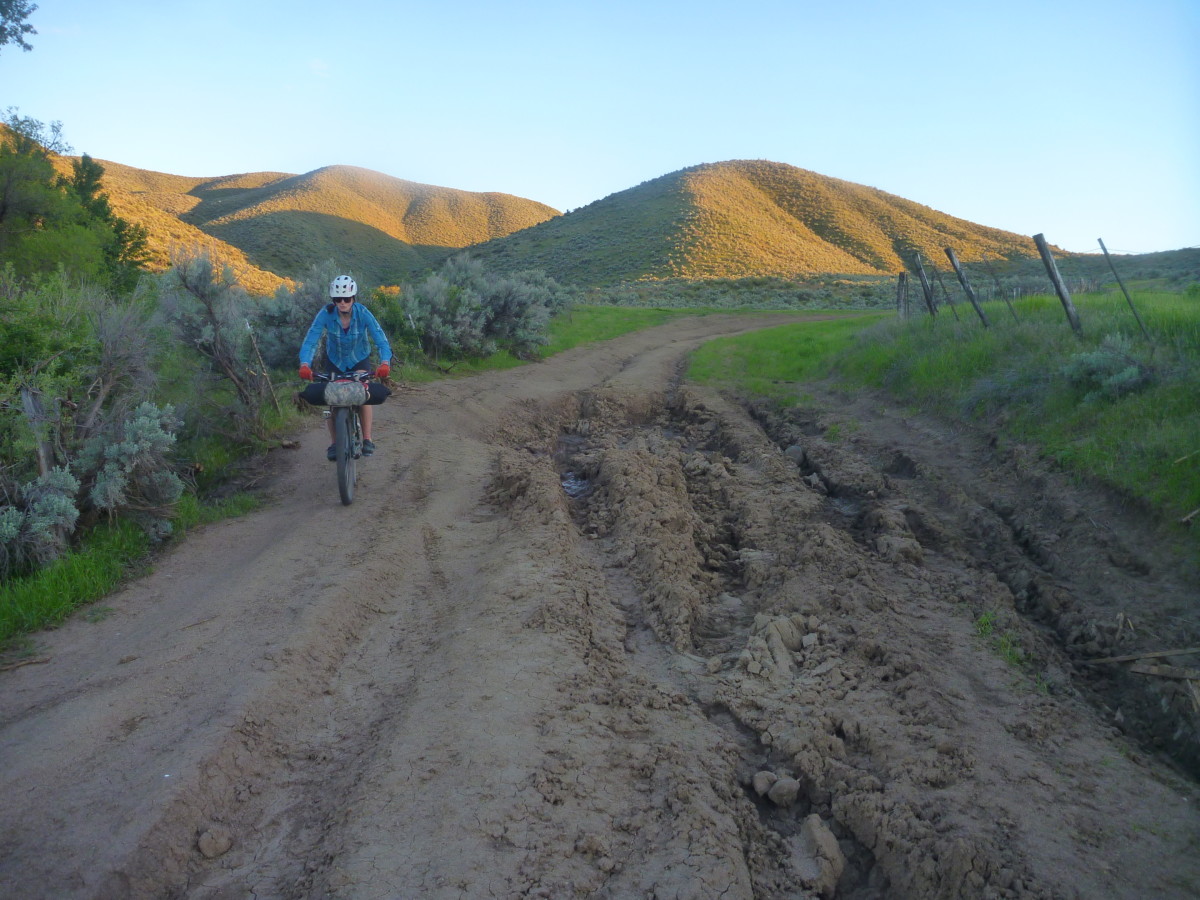
The broad valley north of the Payette river and east of the West Mountain range has offered hospitable springtime conditions in years past. Last year we rode to the Montour campground and did a big, looping day ride back to camp on the “Grindola” route. Photos on this post were taken over that weekend in May 2017. This year we’re thinking of heading a little farther north into the Payette National Forest and (hopefully) spending the night on the Little Weiser River. Come join us!
First of all, let’s get the disclaimer out of the way. This is not a bike event. This is a self-supported, weekend bike ride with a group of friends. All riders are responsible for their own safety and enjoyment, should come prepared to be 100% self-sufficient and have their own self-rescue or bailout plans in place. Do not count on cell phone service. We are offering a route suggestion, some potentially useful (or potentially inaccurate) information and nothing more. That said, riding bikes is fun, overnight rides are even more fun and we welcome any and all riders who want to join in for any portion of the weekend’s journey!
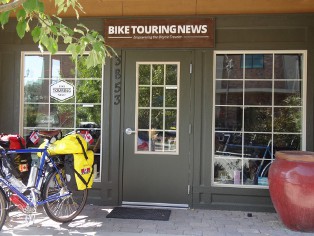
OK, let’s get to the good stuff! The plan is to close the shop a couple of hours early so we can leave Bike Touring News HQ at 4pm on Friday, March 30. That’s right, the shop is CLOSING EARLY! That will give us plenty of daylight for the 27-mile pedal through the Eagle Foothills and down the other side to the Montour WMA campground.
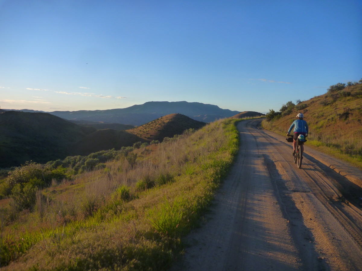
The descent down the Johnson Creek road hasn’t received any maintenance (that we know of) at least since last summer, maybe longer. It is likely to be in poor shape and may not be 100% rideable. There is one extended section where the creek has taken over the road. This mile-ish stretch will likely be running with at least a couple inches of water and is paved with round, sometimes loose babyhead rocks. Be prepared to walk/carry your bike if the going gets rough.
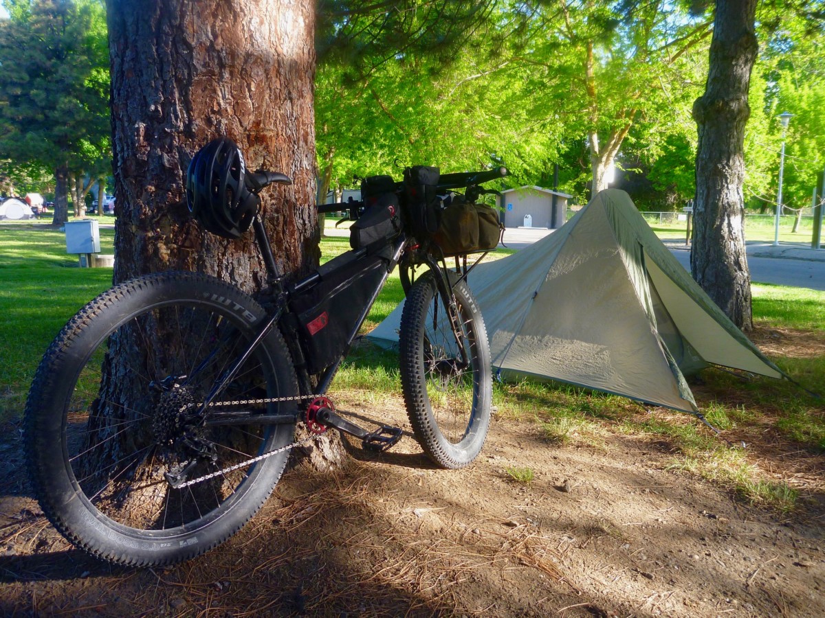
The Montour Campground is tucked in a shady grove just on the north side of the Black Canyon Reservoir section of the Payette. The campground will likely still be closed for the season but water has flowed and bathrooms have been unlocked in previous springs.
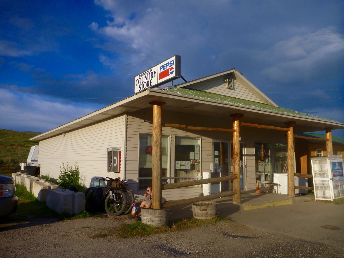
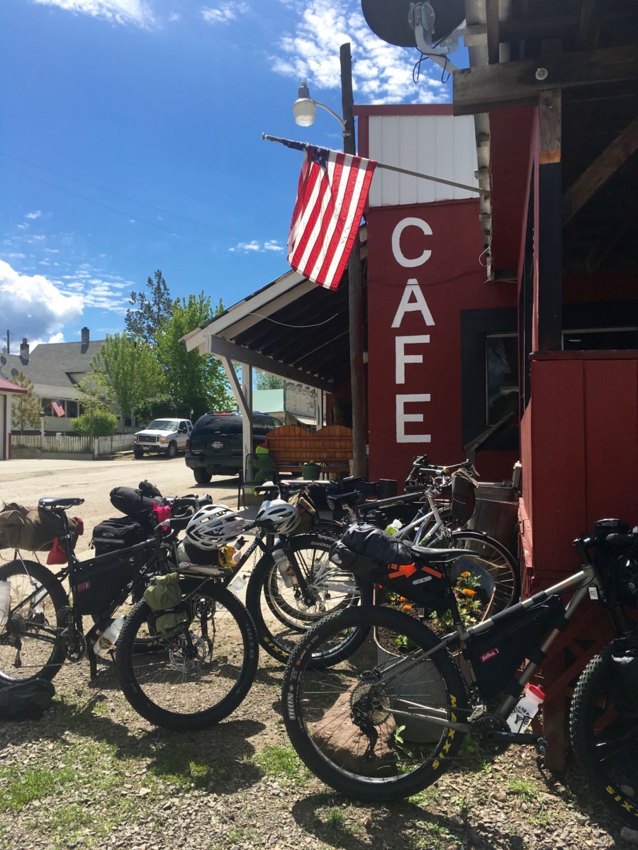
The Montour Country Store and Triangle Restaurant (marked on the RideWithGPS route) are just a short pedal away for meals, beverages and general resupply.
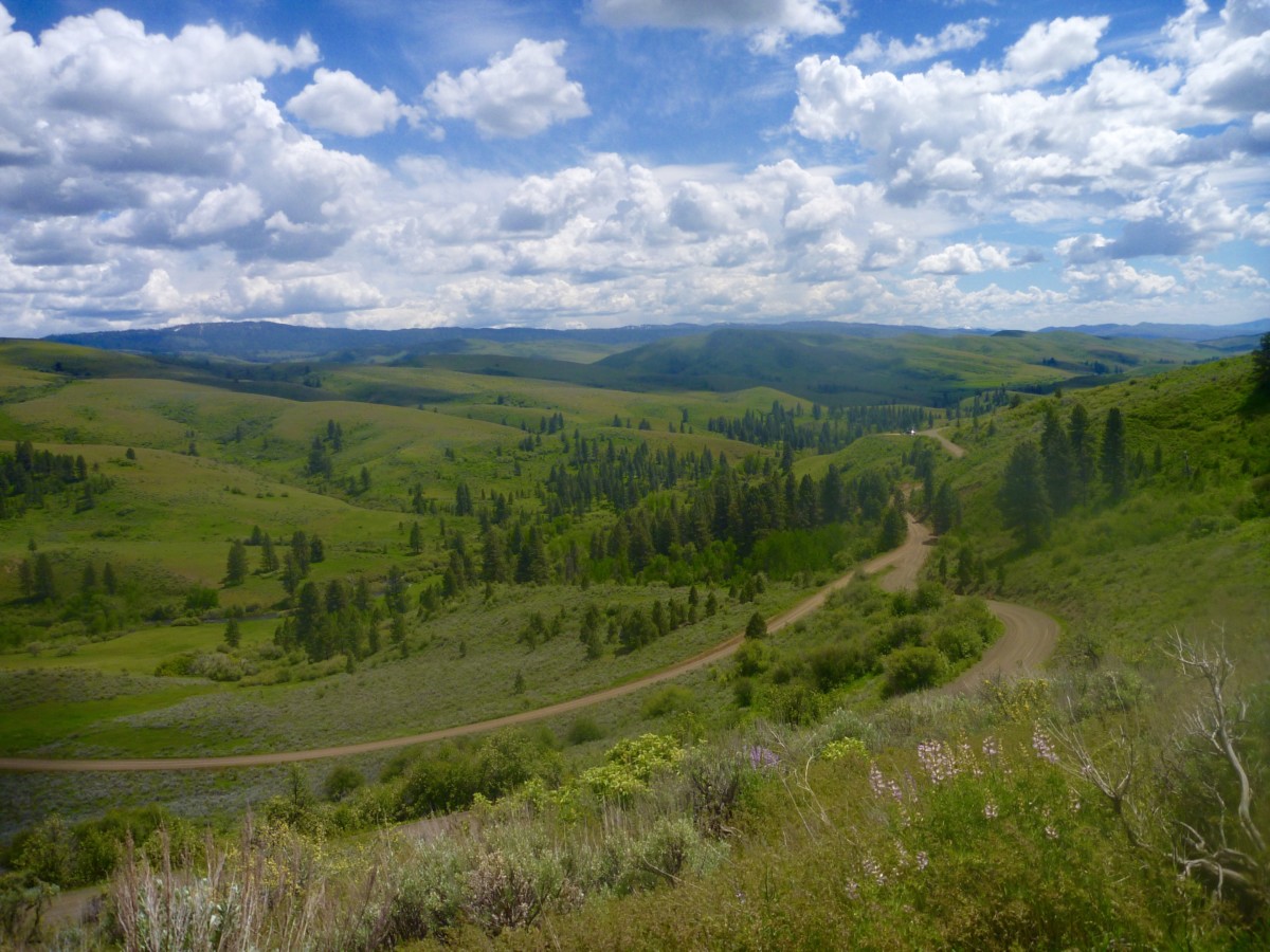
Day 2 will cover around 50 miles of paved and unpaved roads. We’ll gradually climb northbound through Ola with a probable stop at the Ola Cafe for lunch before continuing into the fringes of the Payette National Forest. The Cafe will be the last on-route resupply until we pass through Emmett on the way back south, so stockpile those calories!
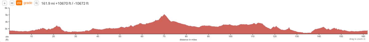
The day will end with the climb over the Mill Creek Summit and descent to the Little Wieser River, camping at the Big Flat campground or thereabouts. This will be new territory, so we’re not certain what to expect. We’ll just have to go there and find out.
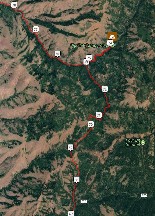
Word from the Ranger on duty at the Council district office is that the roads up to and over the Mill Creek Summit (topping out right around 5,000 feet) should be snow-free. I (Ryan) was surprised to hear that given the snow line here in Boise but we’ll just have to go there and find out.
Per the Ranger, the campground is closed but still useable – though toilets may be locked and water shut off – or we may seek an alternative spot to dispersed camp. Will there be fish in the river? We’ll just have to go and find out.
Day 3 will be the big day mileage-wise with a 90+ mile push back to Boise. However, we’ll gradually be losing elevation and the roads should be pretty fast as we head southbound toward Emmett. We’ll refuel in town for the climb out of the valley before dropping back to Boise through the Eagle foothills. With an early start on Sunday morning we should have plenty of daylight for the return trip.
Can’t get out of work early on Friday? Looking to trim some miles or skip the ride out of town? Park your vehicle at Montour and ride Saturday and Sunday! Shorter overnight and day ride options also abound in the area. Choose your own adventure!
Weather: NOAA weather near Big Flat CG (near high point of the ride) Lows are forecast to be right around freezing, highs in the low-mid 50s. Only a slim chance of precipitation, but it is springtime in Idaho so be prepared for anything.
Bike Choice: Much of the route travels decently paved or maintained dirt roads. Conditions will vary depending on level of maintenance but at least some rough conditions should be expected. The Johnson Creek descent is likely to offer up the roughest conditions we encounter. Any good dirt touring bike with 2″ish tires will probably do fine over 95% of the route.
Questions? Email info@biketouringnews.com, call the shop (208-806-2111) or stop by! See you out on the road!