In our overpopulated world, there are few places where humans rarely venture. For better or worse, our species has learned how to make a living in just about every environment on Earth and has left only a precious handful of habitats unmolested. Even in the most remote corner of Idaho – a state with more protected Wilderness than any in the lower 48 – evidence of human history is everywhere. However, just because humans have been everywhere on our planet doesn’t mean they’re still around. Some environments are not welcoming to our fragile and demanding bodies. Despite the challenges of survival in hostile and difficult conditions, wild and unpopulated places call out to us. The allure of traveling where few people have ever gone – places where evidence of human activity is nearly invisible – is a powerful draw. This allure makes Wilderness travel undeniably attractive to a certain breed of people who are capable of cutting the cord and tuning in to a more basic way of living. Five such adventurous souls recently struck out into the vast Wilderness surrounding the South Fork of the Owyhee River for three days of pedal-powered reconnaissance. This is the story of that journey.
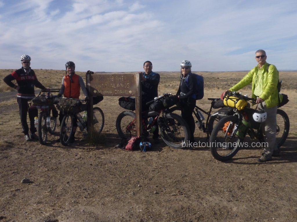
The Crew: (L to R) Bike Hermit, Ryan, Wendell, Sky, Bryan
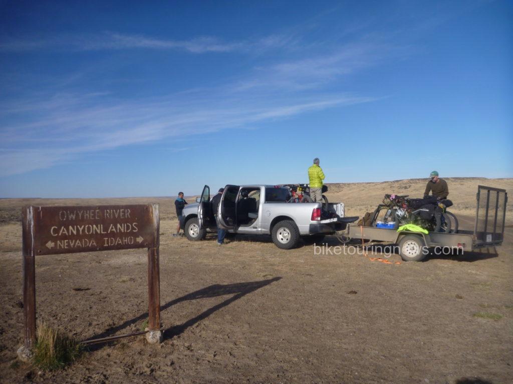
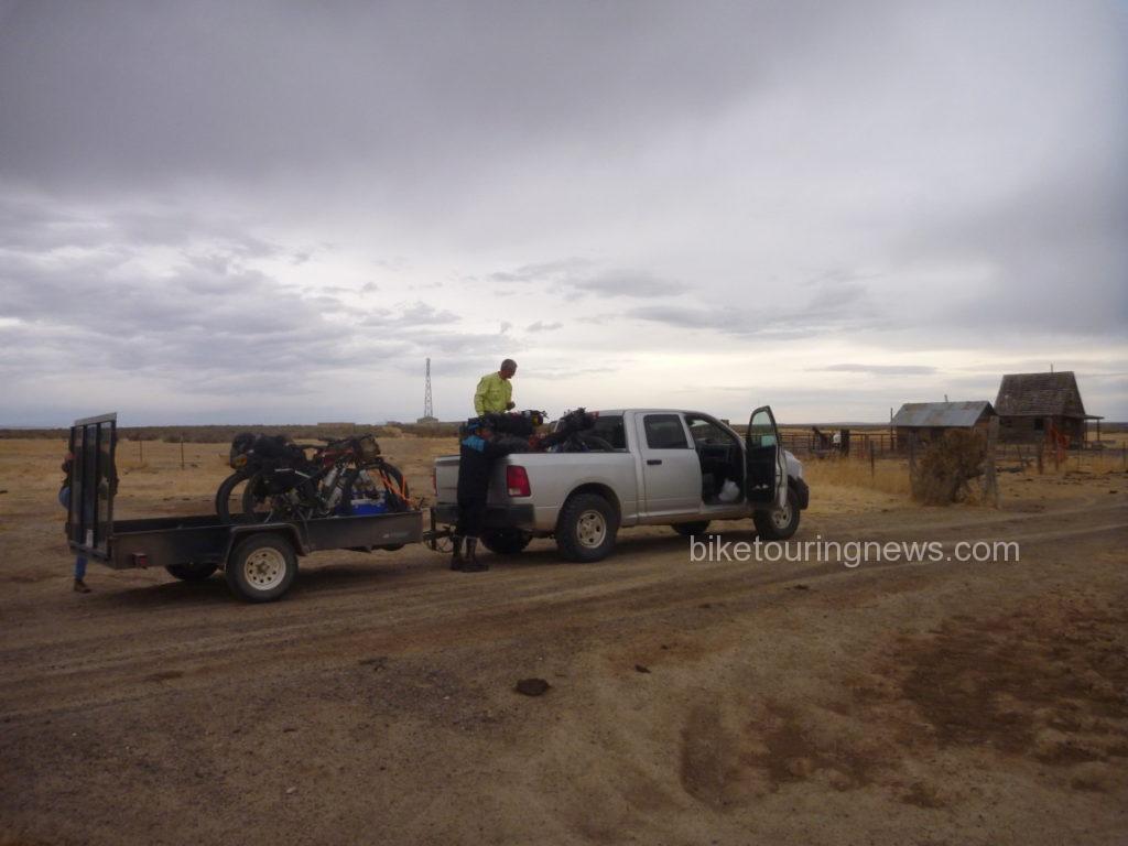
The group convened at the BLM headquarters in Boise to finalize a route and load gear for the 3-hour drive to our drop-off point east of the Duck Valley Indian Reservation, just north of the Nevada border. After the long drive riding three-abreast in the pickup, we were happy to stretch our legs and breathe the sage-perfumed air while we unloaded bikes.
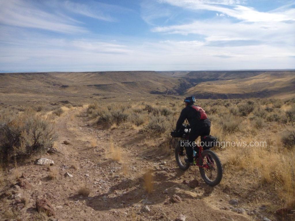
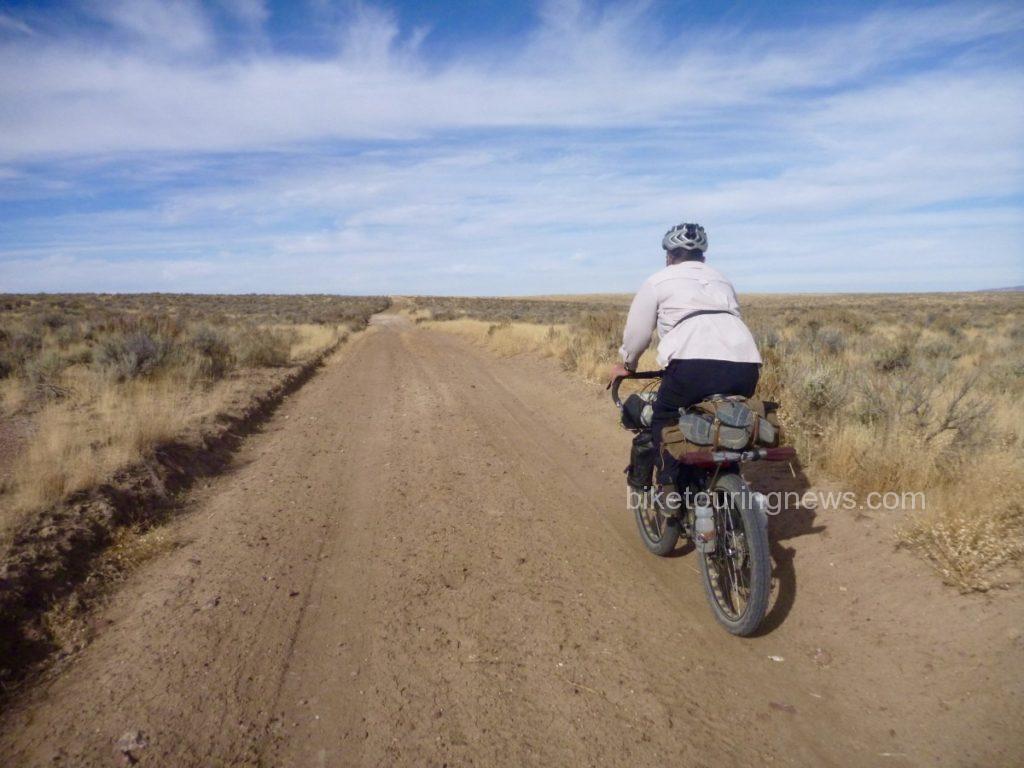
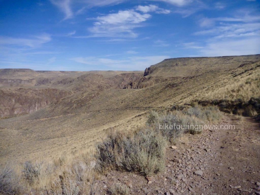
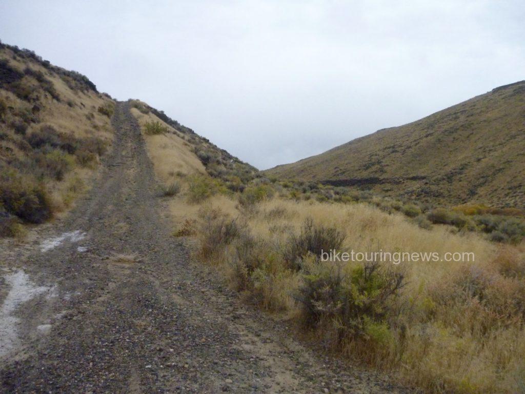
We set off to the west just after 11am, pedaling through Horse Basin toward the Wilderness Boundary. The miles passed with relative ease on the well packed two-track under sunny skies and with scarcely a hint of wind. We ground our way up a gradual climb to the plateau and turned to the south in order to survey a longer section of wilderness boundary.
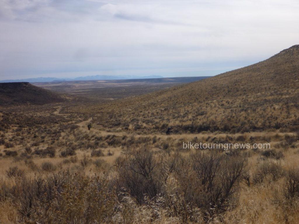
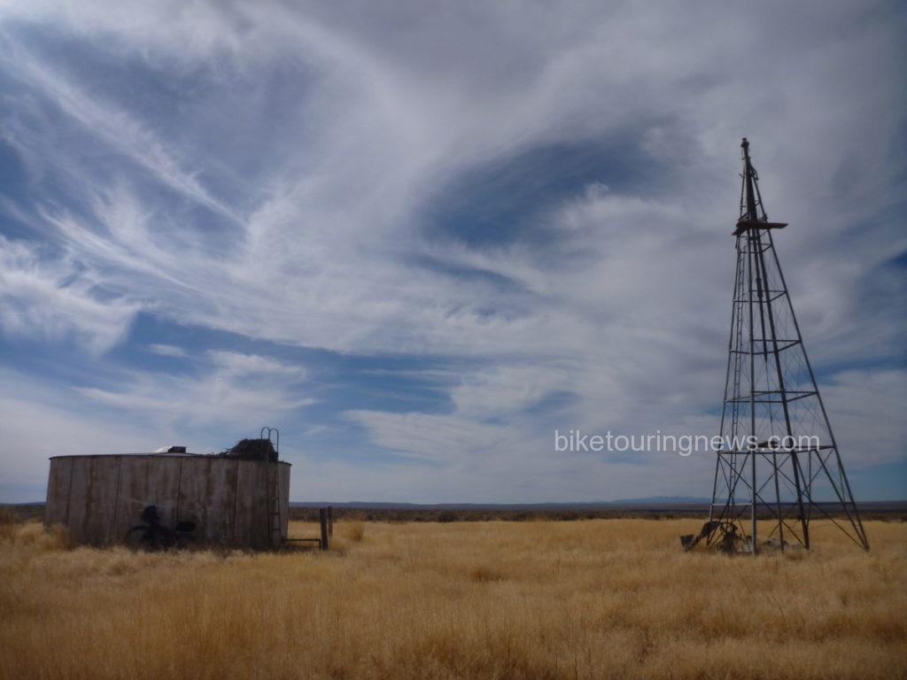
This section of doubletrack was among the smoothest any of our group had ridden in the entire region and a slight tailwind began to push us northward. The sea of sage was interrupted by two water tanks and windmills; aging remnants of ranch infrastructure. Each one sat in a grassy circle cleared of sage and featured abandoned eagle nests tucked into the ladder handles of the water tank. A draft of cool air blew up from the dry well near one of the tanks. A rock dropped down the tube never found water.
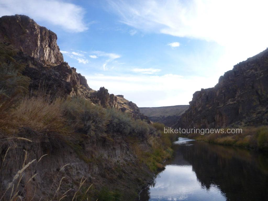
As we turned to the west along the boundary line, we came to a rock outcropping and saw the land fall away ahead of us. From here, we descended into Wilderness along the Coyote Hole Cherrystem to the bank of the South Fork where we would make our first camp. The road dropped gradually at first but became steeper as we neared the canyon rim.
A badger scuttled off the road as we approached, making off into the underbrush. With sheer rock walls on both sides, we followed the loose, rutted track down its final plunge to river level, finding the ruins of a stone house, livestock pen and even some rusting farming implements.
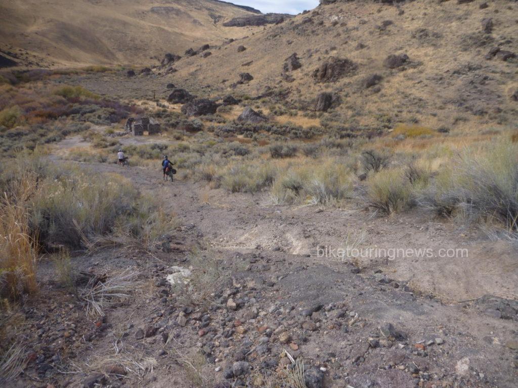
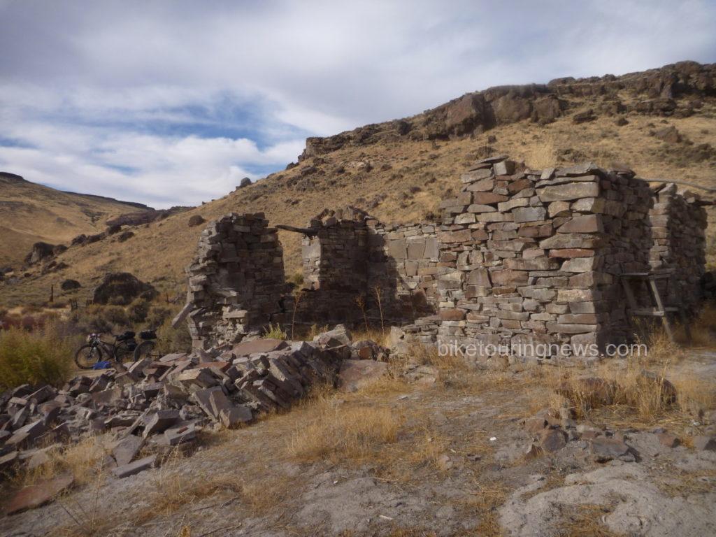
The prospect of scratching a living out of the side of this remote stream seemed pretty daunting, but compared with the barren plains above this was a paradise of plenty. Springs bubbled out of the rocks above, delivering sweet water to wet our whistles.
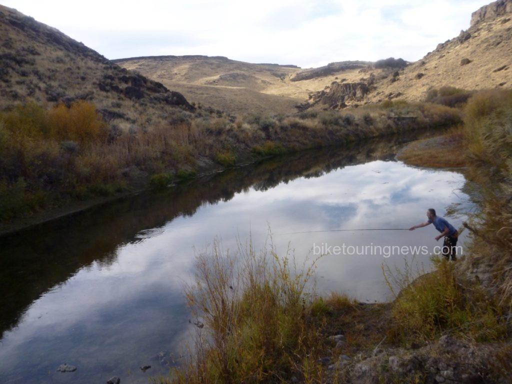
A brief exploration also revealed a river teeming with fish, which turned out to be Northern Pikeminnows. This provided an ideal opportunity to test the borrowed Tenkara outfit the Bike Hermit packed along. Thanks for the loan, Don! This was the first time fishing with Tenkara for me and the Bike Hermit, so look forward to more about that experience in a future post.
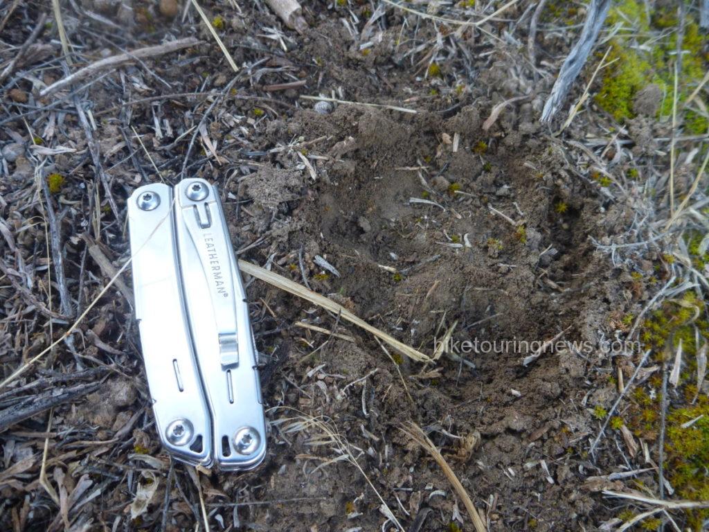
We awoke to temperatures barely above freezing and crawled from the warmth of our shelters to make our breakfast and coffee. I noticed the tracks of what appeared to be a mountain lion just on the edge of our camp, along a path we had trod the evening before to access the river. Did we have a visitor in the night? I can’t say for sure, but it certainly appeared that the big cat had stalked through the bush less than 15 yards from where we slept.
It seemed nobody was in a big hurry to tackle the climb back out of the river canyon. The first pitches were definitely unrideable on our loaded bikes and even the more forgiving sections tested our legs and determination. However, the exertions allowed us to quickly shake off the morning’s chill and we found ourselves back on the high plateau. We made good time northbound along the boundary line, headed for the river ford near the 45 Ranch.
Once atop a small rise, we were greeted with a stunning panorama of the massive gash in the earth containing the South Fork. It was clear that the descent to the 45 Ranch was going to be a wild ride, so we strapped our gear down tight and dropped in. The well-traveled road was delightfully smooth in some spots and terrifyingly rough in others. The switchbacking grade led us down to the homestead of the 45 Ranch, a privately-owned ranch in partnership with the BLM and the Nature Conservancy. We passed by the ranch on the way to the boat launch where we would ford the South Fork. 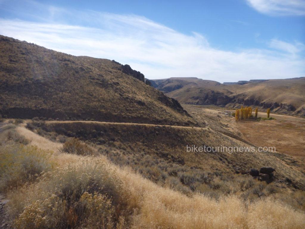
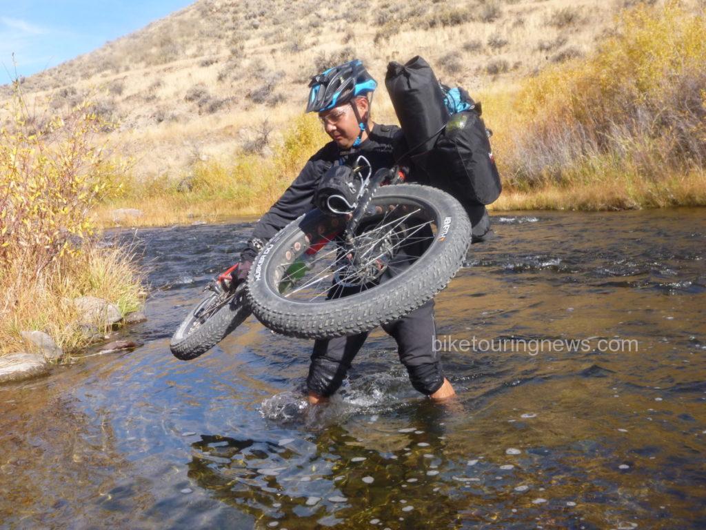
We paused at the river ford to partake of some victuals and prepare ourselves for the uneven footing and swift water. Group members crossed the river using varying tactics. Some – like Wendell – carried their bikes above the knee deep water…
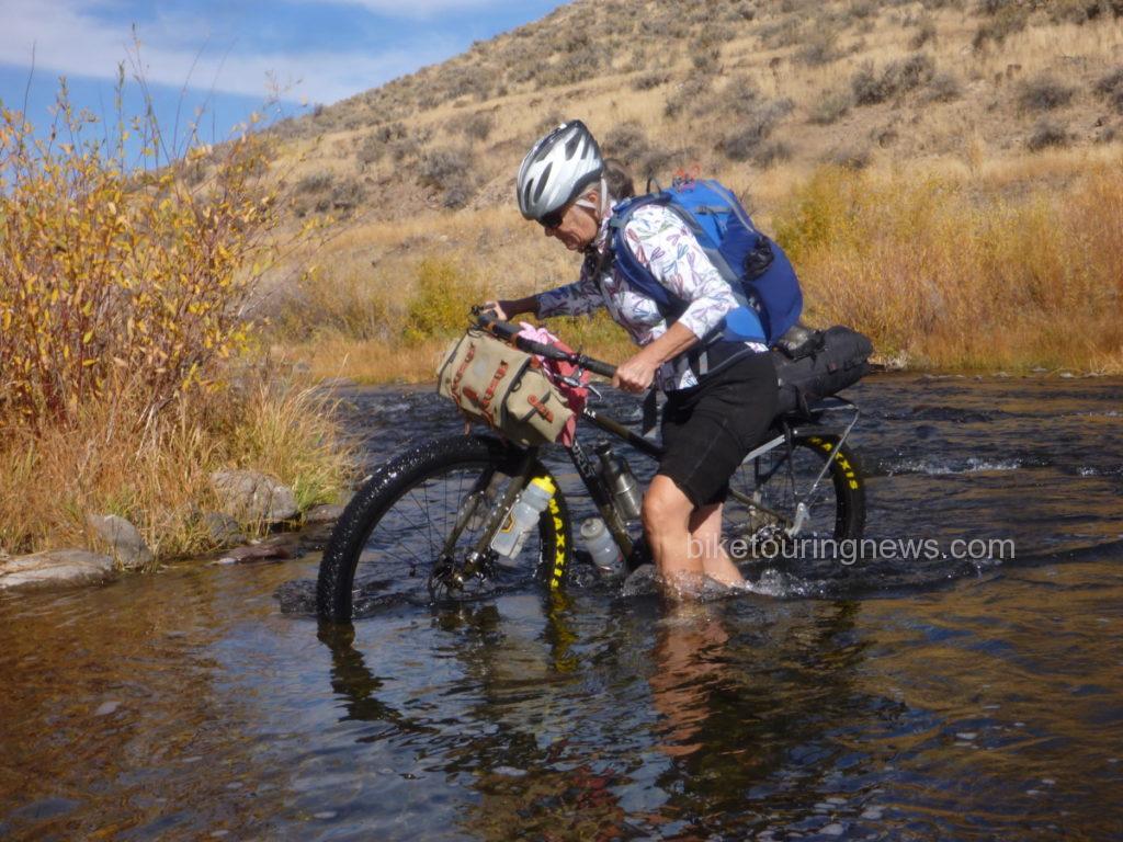
Some – like Sky – pushed their bike along the bottom. I wonder who does her maintenance…
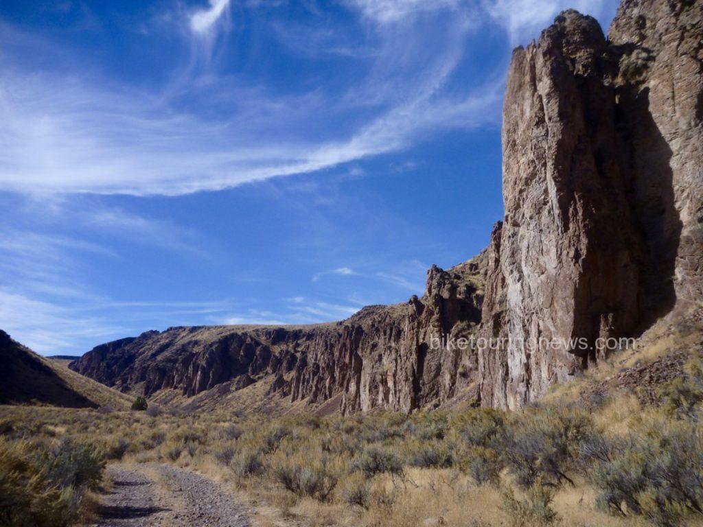
After crossing the river, we left ranch property and returned to the Wilderness along the Little Owyhee Cherrystem. We started out on a flat, rocky double-track between steep rock walls. However, when traveling through the Canyonlands, what comes down must always go up.
Our mild and scenic road soon turned steep and nasty. This climb out of the river canyon would be the most trying of the trip. The combination of intense midday sun, steep grades, deep ruts, off-camber tread, loose dirt and rolling rocks made this climb mentally and physically challenging. The left-hand track was reasonably smooth and appeared rideable but the loose soil and steep camber caused wheels to slip into the rut at the slightest shift of weight. Most of us were forced to push our bikes nearly all the way up from the valley floor.
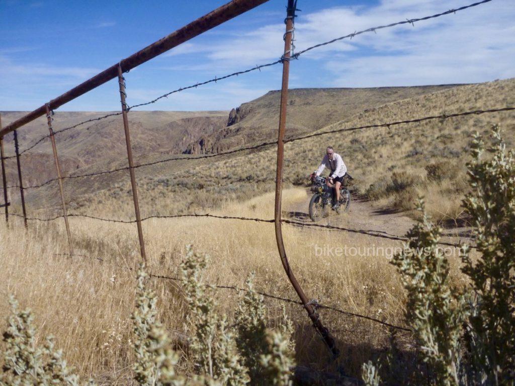
The climb ground upward and topped out just uphill from a wide-open barbed wire gate. One downside to riding in the Canyonlands is that climbs are rarely rewarded with descents as they would be in the mountains. Instead, we were taunted by steep rollers and an increasing headwind as we headed south, keeping the Wilderness boundary on our left.
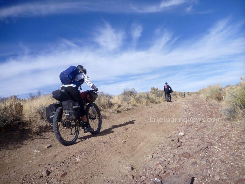
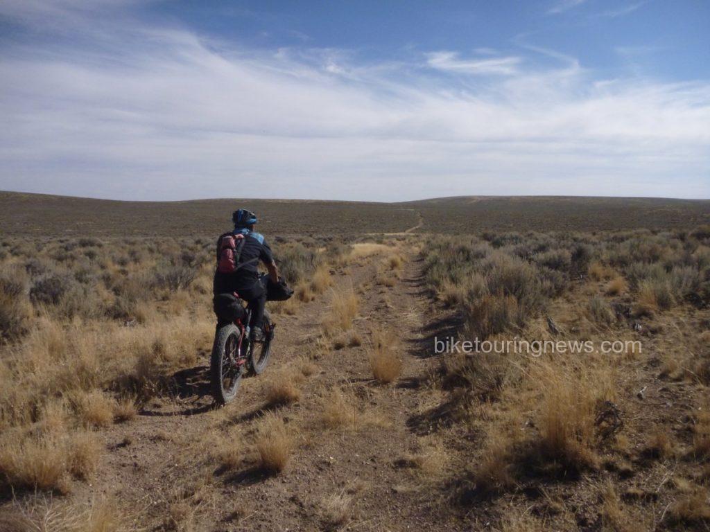
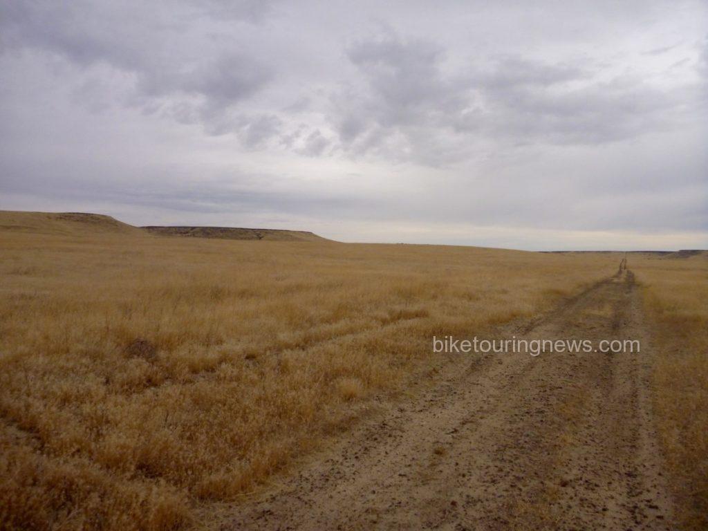
This section is among the least-visited in the entire Owyhee Canyonlands Wilderness. Our track showed little evidence of human travel within the past several months, if not longer. Animal scat, burrows, anthills and sagebrush abounded. Jackrabbits, coyotes and birds of prey appeared the be the only main road users. We investigated the heads of the Walcot and South Fork Cherrystems, neither of which had seen traffic in quite some time.
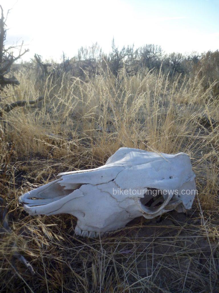
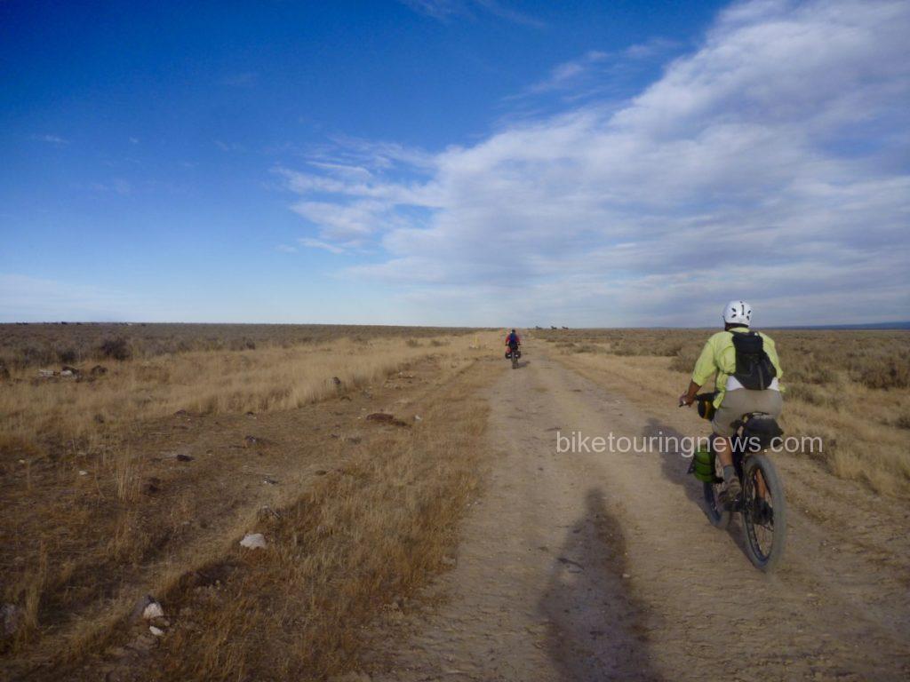
After 14 “desert miles” riding through the wide open ocean of dust and sage along the boundary line, we crossed through a gate. Somewhere past the gate we crossed the unmarked state boundary and into Nevada. South of the fence, evidence of heavy horse use was everywhere. Hoofprint potholes and heaping piles of “road apples” littered the double track and made for rough going. The stiff headwind made life even more difficult. We were feeling the effects of the tough climbs and long miles as we sought shelter and water for our evening’s camp. Shadows were already growing long in the road, obscuring rocks and holes in the right-hand track. Evidence of the fragility of life in the desert was all around.
After cresting a small rise, we sighted a group of the horses responsible for the hoofprints and manure piles. They became aware of our presence and pricked their ears in our direction. However, they weren’t about to let us get very close.
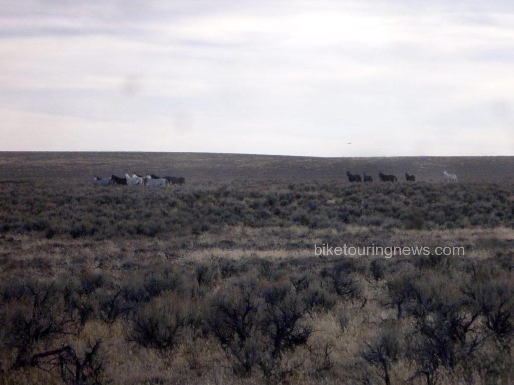
They turned tail and headed east, raising a mighty cloud of dust as they went.
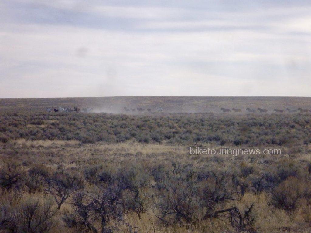
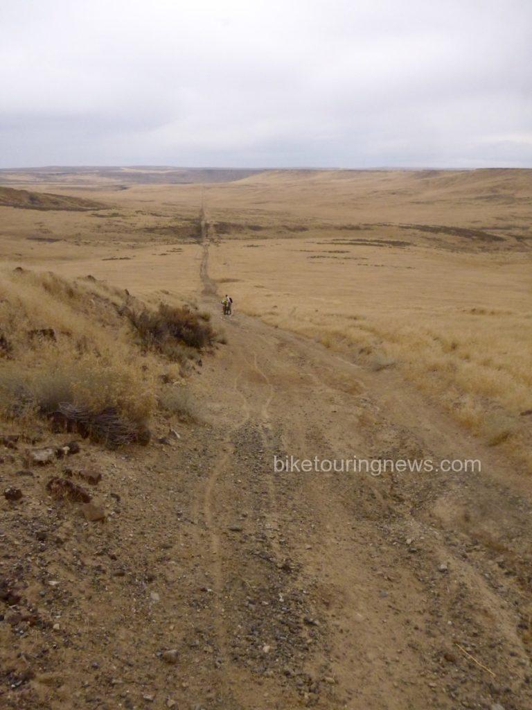
We encountered another group as we picked up the Paiute Pipeline road. They’re just visible on the horizon in the photo below. Despite their skittishness, we were in their territory and this wouldn’t be the last we’d hear of the horses. We pedaled on, feeling battered by the rough road, headwind and long miles. We were quite ready to reach our riverside camp and put our bikes to bed.
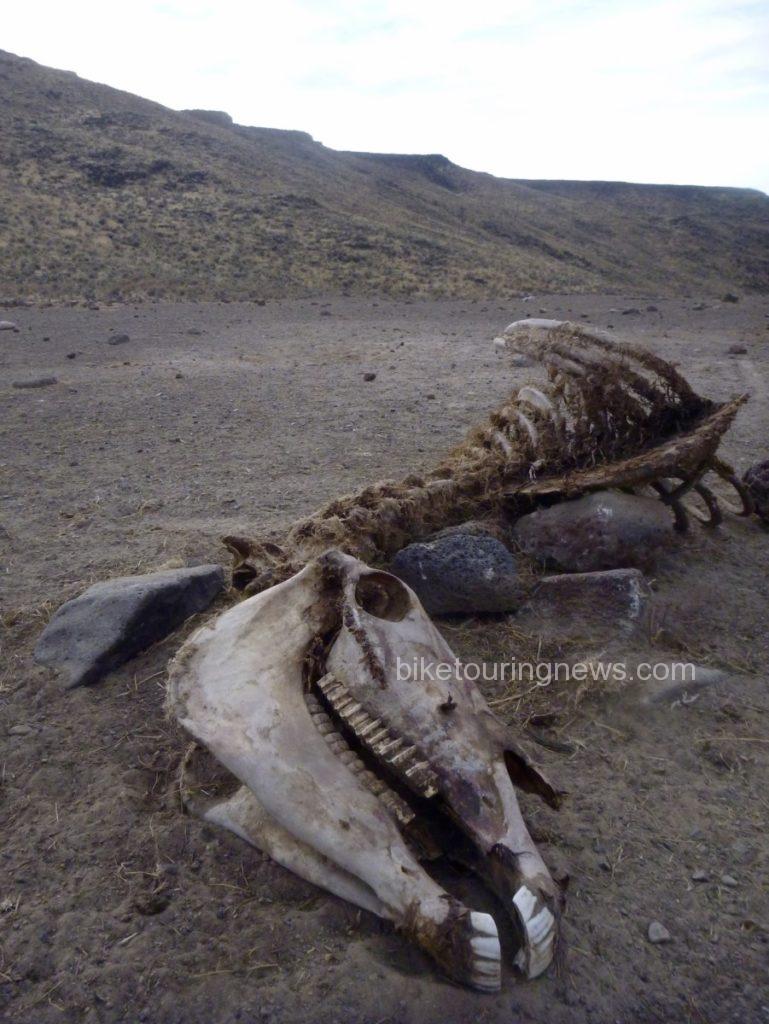
Yet again, we braved a steep, rocky and loose descent into the river plain. From our high point on the plateau, we looked out across the valley to see the Pipeline road continue across the basin and climb straight up the opposite wall far in the distance. Evidence of horse mortality presented an ominous sign as we focused on making camp and put the next morning’s challenges out of our minds.
With a sigh of relief we reached the second river ford of our trip. Again, group members took varying approaches. Wendell opted to stay on the south bank and make his camp above river level. The rest of the crew elected to make the river crossing now rather than brave the chilly water in the morning. In our depleted and mentally deficient state, pitching our camp in the middle of the road didn’t sound like such a bad idea. We prepared our respective meals and turned into our shelters under a clear, starry sky. The crystalline starscape is one of the biggest rewards for traveling in this tough and forbidding landscape. Situated in the middle of one of the largest unpopulated areas anywhere in the United States, light pollution is practically non-existent. I lay in my bivy sack for quite some time, watching shooting stars and soaking in the view of the Milky Way as I dozed off.
On the morning of the third day, the discussion centered around the question, “did you hear those horses last night?!” At least one of the bands had descended from the plain above to river level for their evening drink, coming nearly right through our camp. The thunder of their hooves pounding down the rocky slope shook the ground and woke us from our slumber. The horses retreated when Wendell poked his headlamp out of his tent but continued to snort and stomp along the canyon rim. Despite our fascination with the equine residents, it was time for us to leave this place. We were due at the rally point at 11am to meet Evan and head back to civilization. That meant another grind up from river level, which started right off the bat.
This short but brutally steep stretch of Pipeline Road was littered with loose, round rocks that rolled like billiard balls at the slightest touch. Even on an unloaded fatbike, I’m not sure if it could be climbed. We had a difficult enough time walking up the cruel grade but were pleased that it didn’t last long. As we headed northeast toward Idaho, evidence of horses faded and the track grew smoother. A few rollers in the basin even delivered enough of a speed boost to get us into our big chainrings, perhaps for the first time on this odyssey.
The climb out of the basin loomed large in the distance and we prepared ourselves for the final grunt of the trip. The grade grew steeper the farther up the pitch we climbed and we were all forced to push our bikes to the rim. Wendell and I waited at the top, watching the rest of the group approach and eyeing the route we had taken yesterday and this morning across the wide-open bowl of grass.
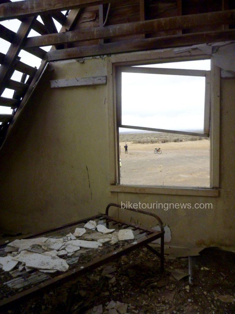
Now back in Idaho, we continued to follow the Pipeline Road until we came across a dilapidated ranch outpost, complete with a two-story cabin, outhouse, workshop and corrals. Despite the run-down appearance, it was clear that the property still got some occasional use but was no longer suitable as living quarters. The cabin’s frame and foundation were solid but the roof and windows were long gone and the interior had fallen into deep disrepair. We struggled to imagine the difficulty of survival through the bitterly cold and windy winters out here on this exposed, isolated plain.
Just as we completed our explorations of the cabin and prepared to continue toward our meetup point, we saw the government pickup rumbling down the road toward us. Our Wilderness adventure was finished. With mixed emotions, we loaded our bikes and piled back into the truck for the drive back to the modern world.
Despite – or perhaps because of – the challenges and difficulty, trips to remote corners of our planet leave us with a better sense of our place in the world. We are reminded of the fragility of life, especially our own. We are forced to return to a more basic way of thinking that places priority on simple survival. When we return to the relative luxury and security of our normal lives, we do well to retain the perspective gained from journeys such as this. However, regular doses of wildness are essential to the maintenance of that perspective. That’s why places like this deserve to be protected. That’s also why we’ll keep going back.
<—{—<<
Joanie Fauci October 26, 2016, 10:43 pm
Beautiful writing Ryan. The Owyhees are a special place.
Ryan King October 27, 2016, 7:10 am
Thanks, Joanie! Hopefully we’ll have more chances to ride out there this fall. Thanks for reading.
Marc Whitehead October 27, 2016, 6:01 pm
Yes, Ryan, very nice narrative of your trip. Nice adventure.
My brother-in-law, Mike O’Brien, of Boise has traveled some of the same/similar isolated/lonely territory on his two hikes around the boundary of Idaho (each 2,500 miles long). You might want to check out the narratives of his hikes through southern Idaho and northern Nevada and the Oywhees.
Happy travels!
Marc Whitehead
Portland, Oregon
http://idahoptv.org/outdoors/shows/adventureidaho/mike.cfm
His 2014 hike at the age of 71: http://www.trailjournals.com/about.cfm?trailname=16122
http://www.trailjournals.com/IBT2/
2012 hike: http://www.trailjournals.com/entry.cfm?id=371213
Ryan King October 28, 2016, 6:29 am
Thanks for reading, Marc! It is hard to imagine the challenges Mike must have faced crossing the desert on foot. Thanks for sharing!
Linda Paul October 28, 2016, 4:16 pm
Wow! You were definitely in the Owyhee outback! Amazing pics and adventure.
Ryan King October 29, 2016, 10:08 am
Thanks for reading, Linda! If there is such a place as the “middle of nowhere” it is probably somewhere in the Owyhees.